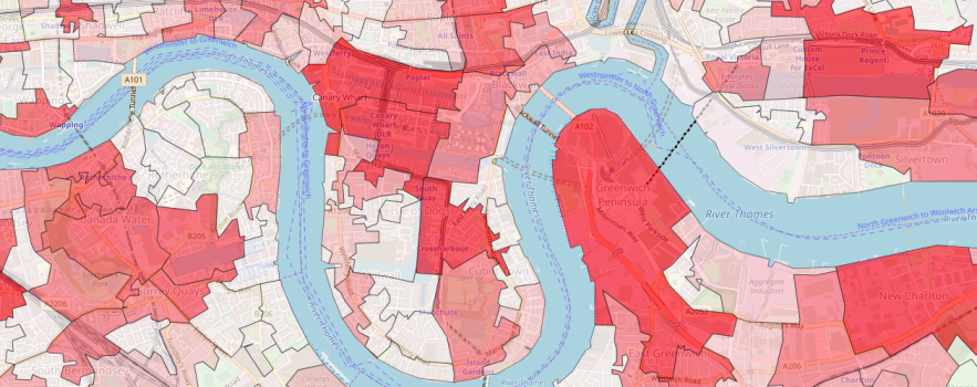
The Food environment assessment tool (Feat) www.feat-tool.org.uk, has just had a big upgrade, and is packed with new feature.
Feat enables detailed exploration of the geography of food retail access. It is designed around the needs of professionals in public health, environmental health and planning roles, locally and nationally. It can be used to map, measure and monitor access to food outlets at a neighbourhood level, including changes over time.
Feat can be used to:
- support planning decisions
- generate local evidence for the development of Obesity Strategies, Local and Neighbourhood Plans, JSNAs and Strategic Planning Documents
- compare food access between neighbourhoods, and see where is changing fastest
- target interventions, and test the effectiveness of planning policies
The original Feat enabled exploration of neighbourhood food access across England. Feat 2.0 extends this access to Scotland and Wales – that’s seven geographic levels of food access estimates, including all 1.7 million postcodes.
You can access detailed maps of six different food outlet types, with food outlet proportions and population adjustments. And you can see how the local picture has changed by comparing today’s data with snapshots going back to June 2014. You can make custom selections of geographic areas so you can easily compare your town or city to others.
Feat produces summary data, in report-ready format. No data collection and no data processing required.
Feat has been developed by the MRC Epidemiology Unit and CEDAR at the University of Cambridge. It is underpinned by the latest scientific evidence about how food access in our neighbourhoods affects our dietary choices and body weight. Find out more about the evidence.
- Access Feat www.feat-tool.org.uk
- Read the new comprehensive how-to guide
- Any questions? Contact feat-tool@mrc-epid.cam.ac.uk

 MRC Epidemiology Unit